Longest Walking Trail in India: The Grand Himalayan Traverse
The longest walking trail in India isn’t just long—it’s an absolute beast. The Grand Himalayan Trail runs over 4,500 kilometers, right from Arunachal Pradesh in the east to Ladakh in the northwest. Most people don’t realize this track literally joins the dots across India’s entire Himalayan belt, crossing through jam-packed forests, wind-whipped mountain passes, villages lost in time, and deserts frozen in cold at high altitudes. This isn’t your weekend hill walk; it’s something trekkers dream about for years.
If you’re wondering, yes, this trail links popular spots like Sikkim, Nepal (for a part), Uttarakhand, Himachal Pradesh, and Jammu & Kashmir. Think of it as a patchwork of treks—some famous, some only walked by nomads or army guys—stitched together to create one epic adventure. You don’t have to hike it all, though. Most people pick sections that fit their comfort, time, or curiosity. The main advice? Even a small stretch is wild and unforgettable.
- Grand Himalayan Trail: The Essentials
- Trail Highlights and Diverse Landscapes
- What Makes the Trail Unique
- Tips for Planning Your Adventure
Grand Himalayan Trail: The Essentials
The Grand Himalayan Trail (GHT) is not your standard mountain trek. This monster of a trail stretches over 4,500 km, putting it among the longest continuous walks on the planet. Its Indian section covers seven states, tapping into the wildest, loftiest corners of the country. Most folks haven’t even heard of parts of this trail because it glues together famous adventure hotspots with barely-mapped sections only locals know about.
The GHT weaves through:
- Arunachal Pradesh (near Namcha Barwa and Mechuka in the east)
- Sikkim’s alpine valleys
- West Bengal (Darjeeling hills)
- Uttarakhand (near Nanda Devi and the Valley of Flowers)
- Himachal Pradesh (Lahaul, Spiti, Kinnaur)
- Jammu & Kashmir (Ladakh, Zanskar)
While the full trail is around 4,500 km, the distance you actually walk depends on the chosen route. The GHT is split into two main routes in the Himalayas—High Route (higher passes, more technical, fewer villages) and Low Route (sticks to the foothills, slightly easier and closer to civilization).
Check out how the trail stacks up against other long hikes:
| Trail Name | Length (km) | Region |
|---|---|---|
| Grand Himalayan Trail (India) | 4,500+ | Himalayas (East to West) |
| Pacific Crest Trail (USA) | 4,265 | California to Washington |
| Appalachian Trail (USA) | 3,500 | Eastern USA |
| Sentiero Italia (Italy) | 6,167 | Italy (North to South) |
The best season to walk? Most trekkers hit the GHT from April to early June or late September to November, dodging the harsh monsoon and heavy Himalayan winters. Remember, you can jump on the trail from hundreds of entry points, but crossing state lines might need permits, especially in places like Sikkim, Arunachal, or restricted border areas.
Basically, the GHT isn’t a strictly marked path. It’s a dynamic, challenging network of trails, village paths, high passes, and ancient trading routes, pieced together for true adventure junkies. Even one small section can push your limits and drop your jaw with scenery. If you want a classic, long-haul trek in India, this is it.
Trail Highlights and Diverse Landscapes
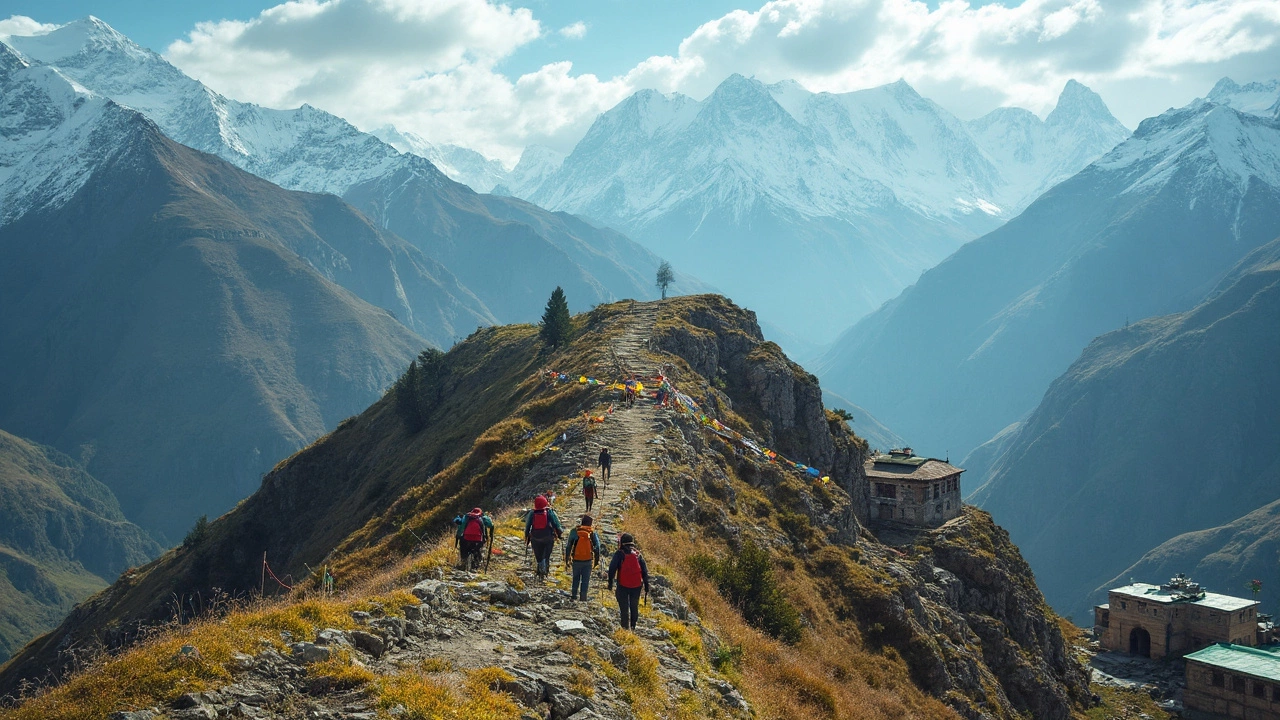
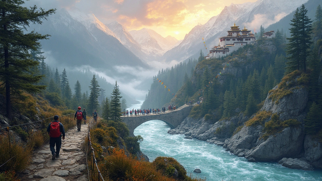
The Grand Himalayan Trail goes way beyond just rocky paths or snowy hills. What makes it stand out is how many different landscapes you get to walk through. Right at the start, you’re crossing lush, subtropical forests in Arunachal Pradesh. It’s humid, green, and full of rare birds you won’t spot anywhere else in India. As you keep going, you hit Sikkim’s rhododendron valleys and crazy steep climbs. Hikers here sometimes run into red pandas or hear monks chanting in hidden monasteries.
Move into Nepal and Uttarakhand, and everything changes. The trail shifts into high alpine meadows, jagged rocky ridges, and thick conifer woods. The weather flips fast—you might be sweating under the sun in the morning but buried in fog by lunch. Trekkers often pass ancient villages where locals still use stone houses and yak caravans bring supplies. That’s not something you’ll get on shorter treks.
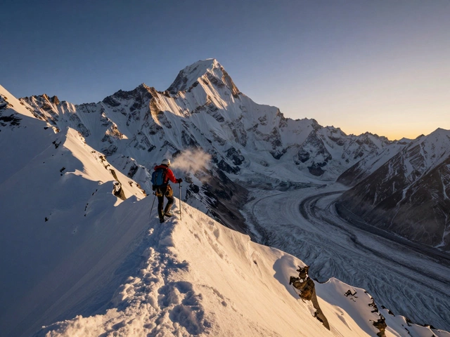
Some of the toughest—and most rewarding—sections come in Himachal Pradesh, Spiti, and Ladakh. Out here, the longest walking trail in India feels almost like Mars. Think barren mountains, wild rivers, and barely any trees. Temperatures drop hard, but the views go on forever. You’ll spot high-altitude lakes like Chandra Taal and see massive peaks up close, often without another soul in sight.
- Trans-Himalayan deserts in Spiti and Zanskar—these regions see hardly any rain and are famous for their moonscape look.
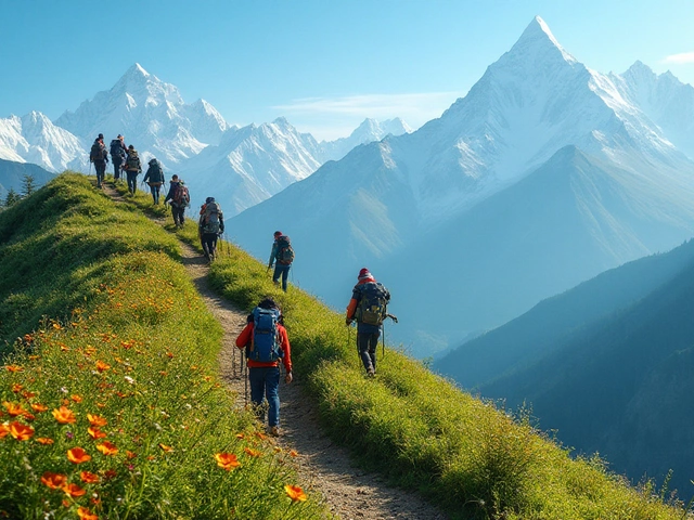
- Mid-altitude pine forests and lush valleys around Uttarakhand’s Nandadevi region—perfect for wildflowers in spring.
- Traditional villages in Himachal Pradesh and Jammu & Kashmir, where homestays give trekkers a chance to stop, rest, and swap stories with locals.
- Snow leopards, blue sheep, and the occasional bear—real wildlife encounters aren’t rare in these remote stretches.
The constant change in terrain means you never get bored. One morning you’re on a suspension bridge across a roaring river, the next night you might be camping on a windy plateau, eating hot Dal Chawal to fight the cold. No other trail in India can pack quite this much variety and real-world adventure into a single route.
What Makes the Trail Unique
What really sets the Grand Himalayan Trail apart isn’t just its length. It’s the way it mixes every kind of terrain and culture you can find in India’s Himalayas. This isn’t a single marked path—think of it more like a mega-network of trails connecting old trade routes, pilgrim tracks, and even yak-herder paths. You’ll cross five Indian states, and each one brings its own vibe. The air, food, and even the way people talk changes every other week you walk.
Few trails on Earth make you dodge landslides on one day, then sip hot butter tea in a Tibetan village the next. If you’re into wild nature, this trail throws everything at you: rainforests, rhododendron valleys, wide-open grasslands, snowy passes, and dry, high-altitude desert. It runs through areas where you spot red pandas in Sikkim forests, mountain goats in Ladakh, or the occasional footprint of a snow leopard—not even kidding. For both serious trekkers and casual hikers, this trail is a buffet of landscapes and surprises.
- The Grand Himalayan Trail winds through over 20 nationally protected parks and wildlife sanctuaries.
- It passes by famous peaks like Nanda Devi, Kangchenjunga, and K2 (on the border).
- Altitude varies from as low as 1,500 meters to above 6,000 meters at some passes.
- The trail runs close to more than 100 different ethnic communities and dozens of languages.
Packed with challenges, the trail isn’t for the faint-hearted. You’ll face sudden weather changes, tricky river crossings, long food and water gaps, and sections where a GPS can’t help much because the signals are iffy. But for a lot of people, this is what makes it pure adventure. The logistical puzzle—finding porters, permits, and local guides—becomes part of the experience.
Many routes are open only in certain months, and it can take around 150-180 days to complete the entire trail, if you’re going at a steady but hardcore pace. Pretty wild, right?
| Trail Fact | Details |
|---|---|
| Total Distance | 4,500+ km |
| States Covered | Arunachal Pradesh, Sikkim, West Bengal, Uttarakhand, Himachal Pradesh, Jammu & Kashmir, Ladakh |
| Highest Point | About 6,000 meters (varies by route) |
| Average Completion Time | 5-6 months (whole trail) |
| National Parks Crossed | 20+ |
For anyone after the longest walking trail India has ever seen, there’s nothing else like the Grand Himalayan Trail. The bragging rights are real if you even finish a chunk, let alone the whole thing.
Tips for Planning Your Adventure
Before you even think about lacing up your boots for the Grand Himalayan Trail, you’ll want to get real about planning. This isn’t a trail you can just show up for. There are so many landscapes, weather swings, and logistical puzzle pieces. Here’s what you actually need to know.
- Longest walking trail India means big distance. Be honest with yourself about which sections you want to hike. You don’t have to walk it all—nobody expects you to. Classic picks include Sikkim to Nepal border, or Spiti to Zanskar. Each has its own personality and challenges.
- Check permits early, especially in areas like Arunachal Pradesh, Sikkim, and some Ladakh regions. Indian citizens and foreigners face different rules, so double-check official state websites or ask experienced trekkers online for the latest info.
- Weather makes or breaks this trail. The best months for most areas? Mid-May to late September, but parts of Arunachal and high regions might open up only for a couple of short windows. Monsoon season (June–August) turns lower sections to slush while the higher regions can surprise you with freak snow even in summer.
- Train before you go. You don’t need to be an athlete, but hiking with a loaded backpack over steep passes at 4,000 meters is brutal if your body’s not ready. Try out multi-day hikes closer to home before going for weeks on the trail.
- Pack light but smart. Lightweight tents, sleeping bags rated for sub-zero nights, decent rain gear, and a reliable water filter are absolute musts. There are long stretches with no villages or shops, so always carry at least a day’s food reserve, even if you plan to eat at homestays where possible.
- Maps and navigation have gotten easier with GPS and apps like Maps.me and Gaia GPS, but don’t fully trust tech. Take printed topo maps for the region—signals drop out often, and power banks die faster in the cold.
- Think about acclimatization. Don’t rush into high-altitude passes, especially in Himachal and Ladakh. Spend a couple of days at increasing heights to avoid altitude sickness. It’s uncomfortable at best; dangerous at worst.
- Plan your exit. Unlike a standard circuit trek, this trail passes through places with patchy transport. Work out which villages have shared jeeps or buses, and save extra cash for emergencies or splurging on a ride if your feet give up.
Chatting with people who’ve done the trail helps. There are social media groups and online forums where folks share real-time info, trail changes, and warnings about landslides or closed sections. Don’t just rely on guidebooks—they get outdated super fast up here.
If you want to keep things safe, consider hiring a local guide for tricky segments. Not only do they know the trail, but they also handle language gaps and can point out hidden gems—like the best momo spot in a random Himalayan village. That’s the kind of stuff you just can’t Google.

About Author